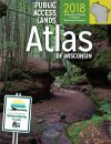
The third edition of the Public Access Lands(PAL) atlas is now available. It is a great resource for planning a Wisconsin winter adventure. Not to mention it would make the perfect stocking stuffer for the outdoor enthusiast in your life.
“The holiday season is a good time to enjoy the outdoors with family and friends. The PAL atlas will give you some great ideas of places you can discover for a great outdoors winter experience this season or any time of year,” said Wisconsin Department of Natural Resources Secretary Dan Meyer.
The atlas includes properties managed by the Wisconsin Department of Natural Resources, as well as federal and county-owned lands. People can download and print these maps free of charge from a home computer.
The original PAL atlas, with 441 maps, two indexes and a glossary is available for $89.95. A separate PAL atlas is also available for each of Wisconsin’s 72 counties for $24.95. Lastly, a DVD with over 450 pages of public lands access data is available for $5.95.
A web-based option for the PAL Atlas can also be purchased through the University Book Store’s digital storefront.
For orders using a check, a mail order form is available on the University Book Store’s website. Please do not send cash or credit card information with a mail order form.
To place an order by phone using a credit card, call: 1-800-993-2665 EXT 5929. In order to simplify the purchasing process, be sure to mention the item number (099127660) in your call.
For more general information, visit the DNR website, dnr.wi.gov, and type the keyword “atlas” in the search bar. To order the Public Access Lands Atlas via the DNR website, simply click the “buy” button.